
“Anyone who doesn’t have a great time in San Francisco is pretty much dead to me. You go there as a snarky New Yorker thinking it’s politically correct, it’s crunchy granola, it’s vegetarian, and it surprises you every time. It’s a two-fisted drinking town, a carnivorous meat-eating town, it’s dirty and nasty and wonderful.” — Anthony Bourdain
OVERVIEW
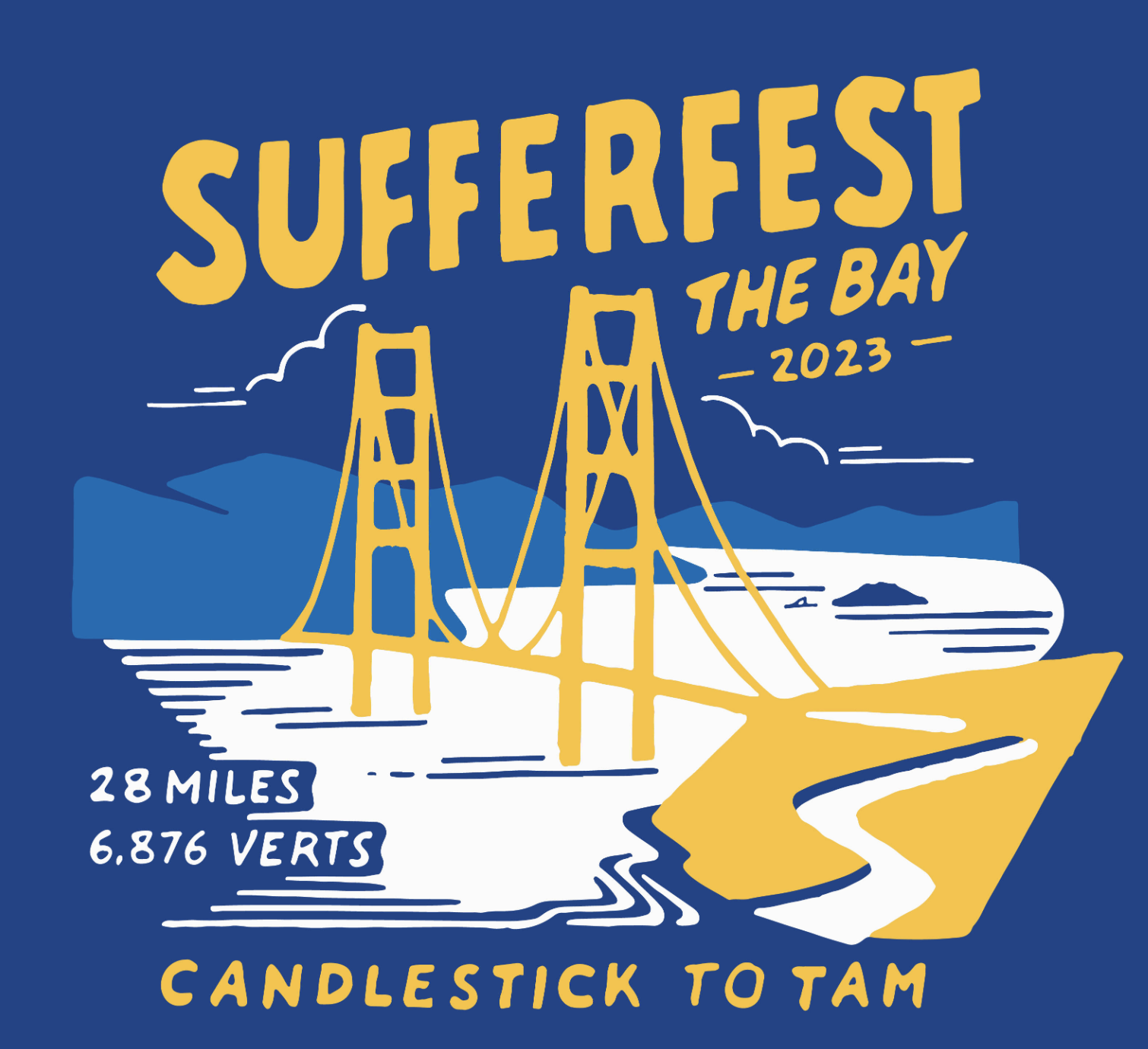
Date: April 20 - April 23, 2023
Distance: ~ 32 miles.
*There was a shuttle between Part I and Part II, and these six miles are not counted in the total.
Elevation Gain: ~ 6,760’
Highest Elevation: 2,504’ at the finish
Lowest Elevation: Sea Level (at the Bay)
Hiking Time: 11 hours moving, plus time waiting for transport…
Average Speed: ~3 mph. (Our usual target is 4 mph)
Sunrise: 6:24 AM
Sunset: 7:53 PM
Hours of Sunlight: 13:29
Average High Temp: 63 F
Average Low Temp: 50 F
Sufferfesters:
Mike A, Pat B, Pat G, Jon L, Angelo, Eric P, Craig S, Todd P, Ryan M, Brad P, Rick, David D, Andrew VD, Ben 4, Nate C, Bryce D, Ryan F, Pehr L, Dave N, Mark T, Bill D, Gabe D, Patrick F, Sean F, Chad K, Ted M, Luke M, Ben 3, Ben T , Drew, and Tim F.
Photo Gallery
Note: We hiked on Friday, some then braved a swim from Alcatraz on Saturday morning, then attended a Giants/Mets game on Saturday afternoon, followed up by wine tasting and dinner.

Strava Link
Maps
Part II below in Mill Valley does not include the extra five miles of our walk down from Mt. Tam to dinner in town.


