"If you think adventure is dangerous, try routine. It is lethal."
-Paolo Coehlo
Overview
Date: April 27, 2018
Distance: 44miles
Elevation Gain: 8,300
Direction: South to North
Highest Elevation: 9,105 (Rainbow Point)
Lowest Elevation: 6,833
Est. Hiking Time: 15hrs
Est. Avg. Speed: 2.7mph
Elapsed Hiking Time: 15:05
Sunrise: 6:40 AM (May)
Sunset: 8:18 PM (May)
Hours of Sunlight: 13.5
Average High Temp: 45 - 70 Degrees (May)
Average Low Temp: 25 (May)
Sufferfesters (22): Rick, Ben, Pat B., Pat G., Tim, Ted, Flood, Bryce, Angelo, Rick S., Chip, Josh, Eric, Nate, Bill, Steve, Ryan, Ted M., Todd, James, Andy, Jeremy
Note: Bryce Canyon was Day I. After walking 44 miles, the next day everyone did the narrows of Zion, and on Day III, just before heading off to the airport/traveling home, an early morning rush to do Angel’s Landing was accomplished.
Strava Link
Photo Gallery

Video
Maps
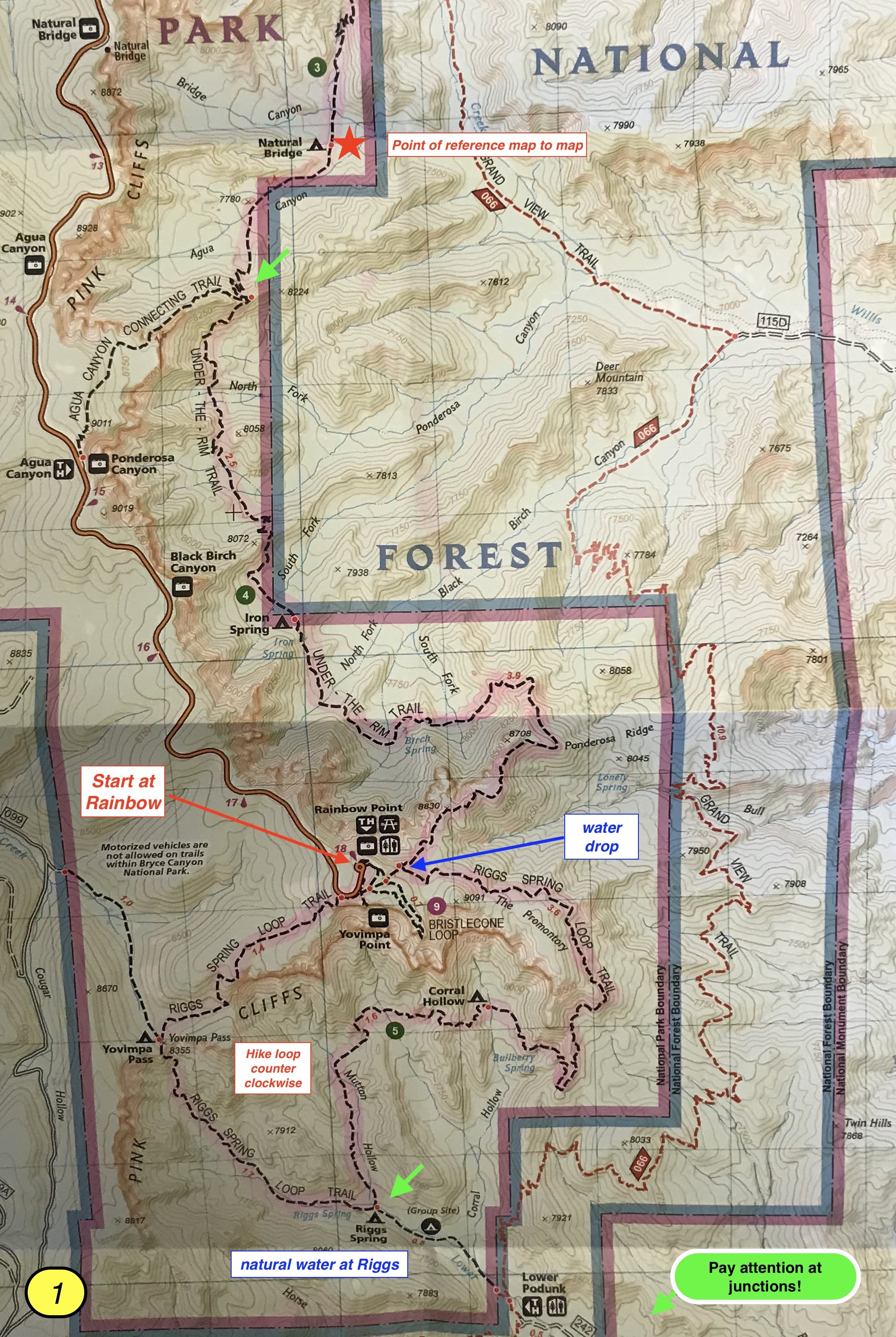
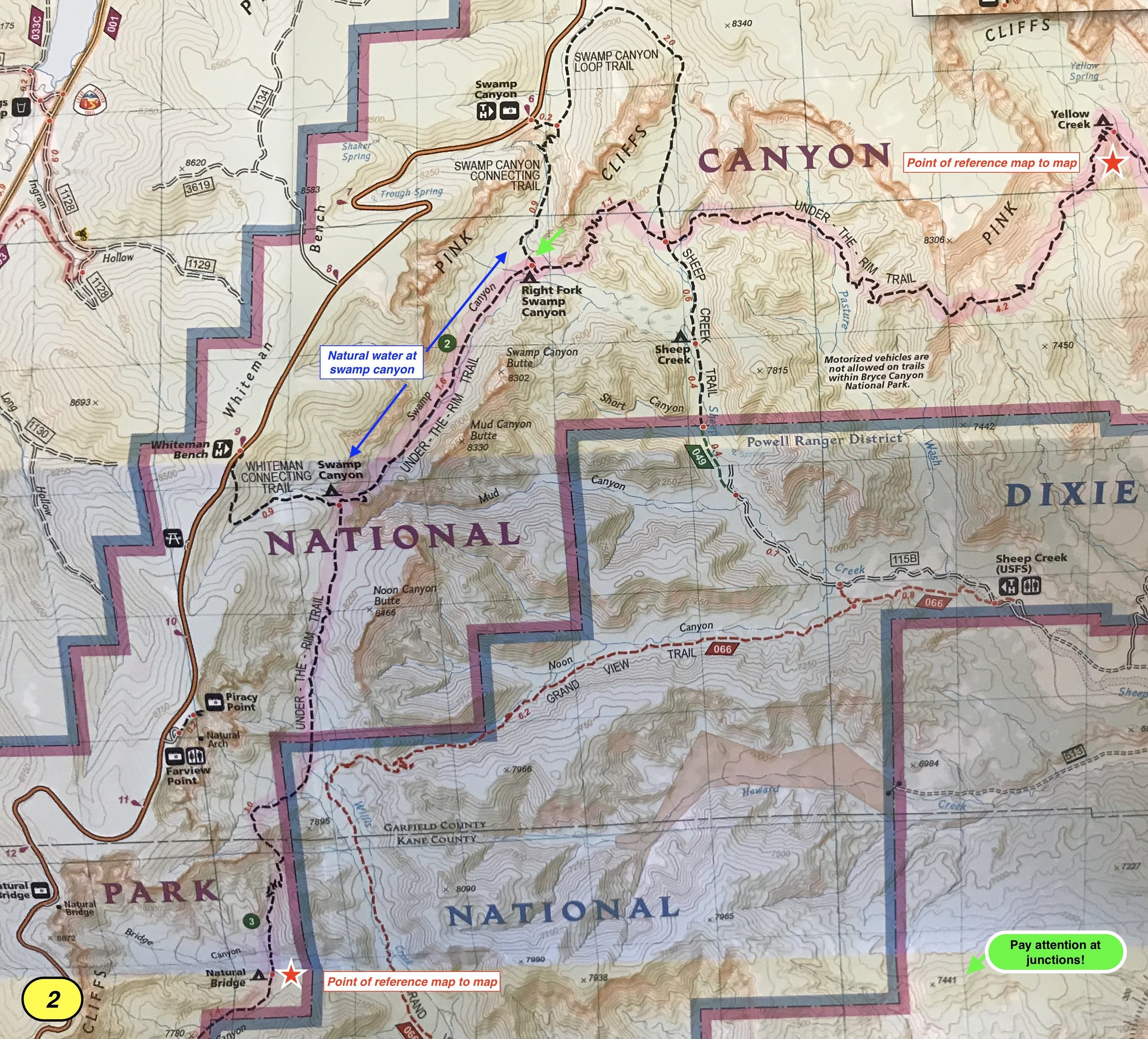
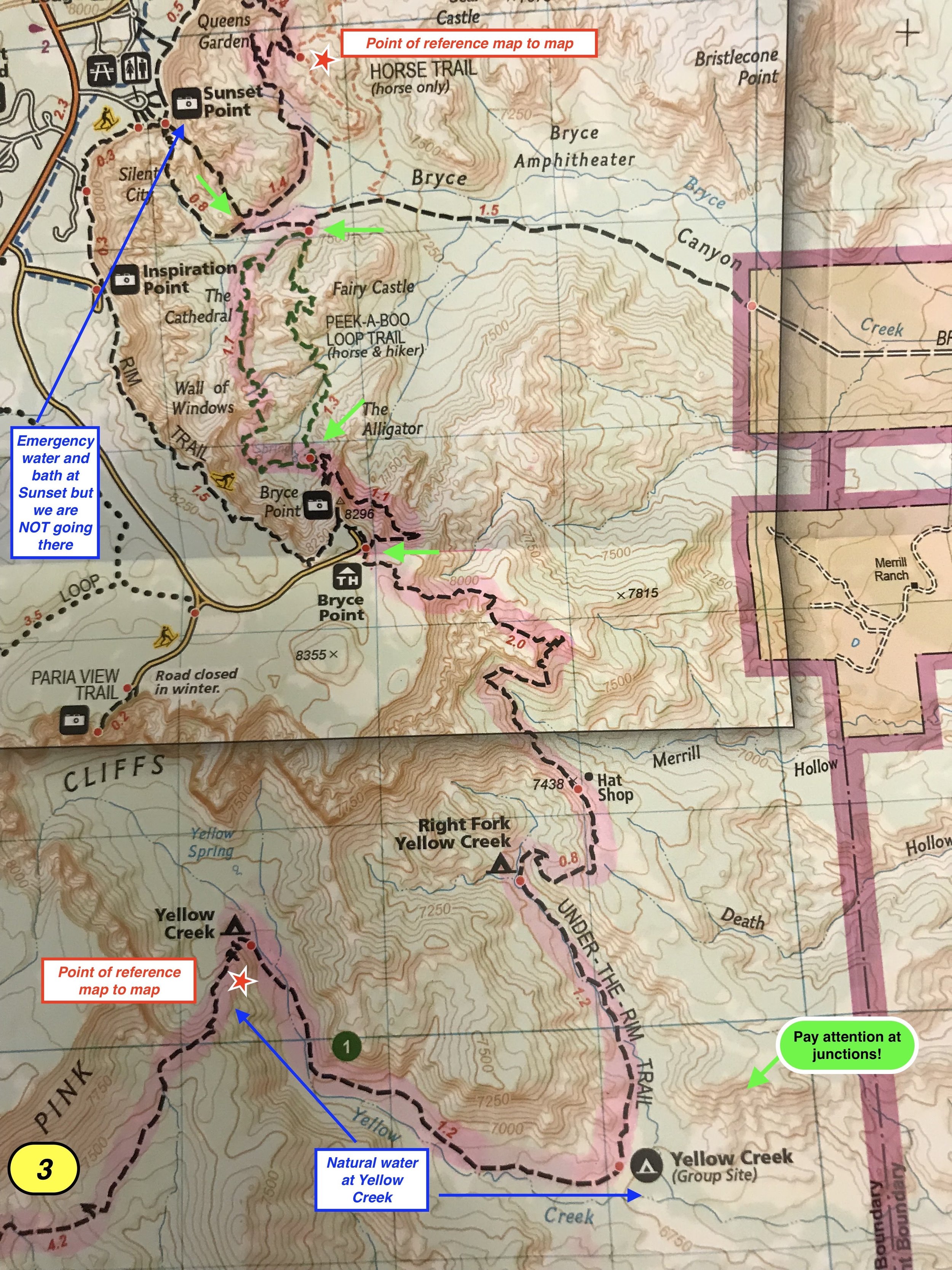
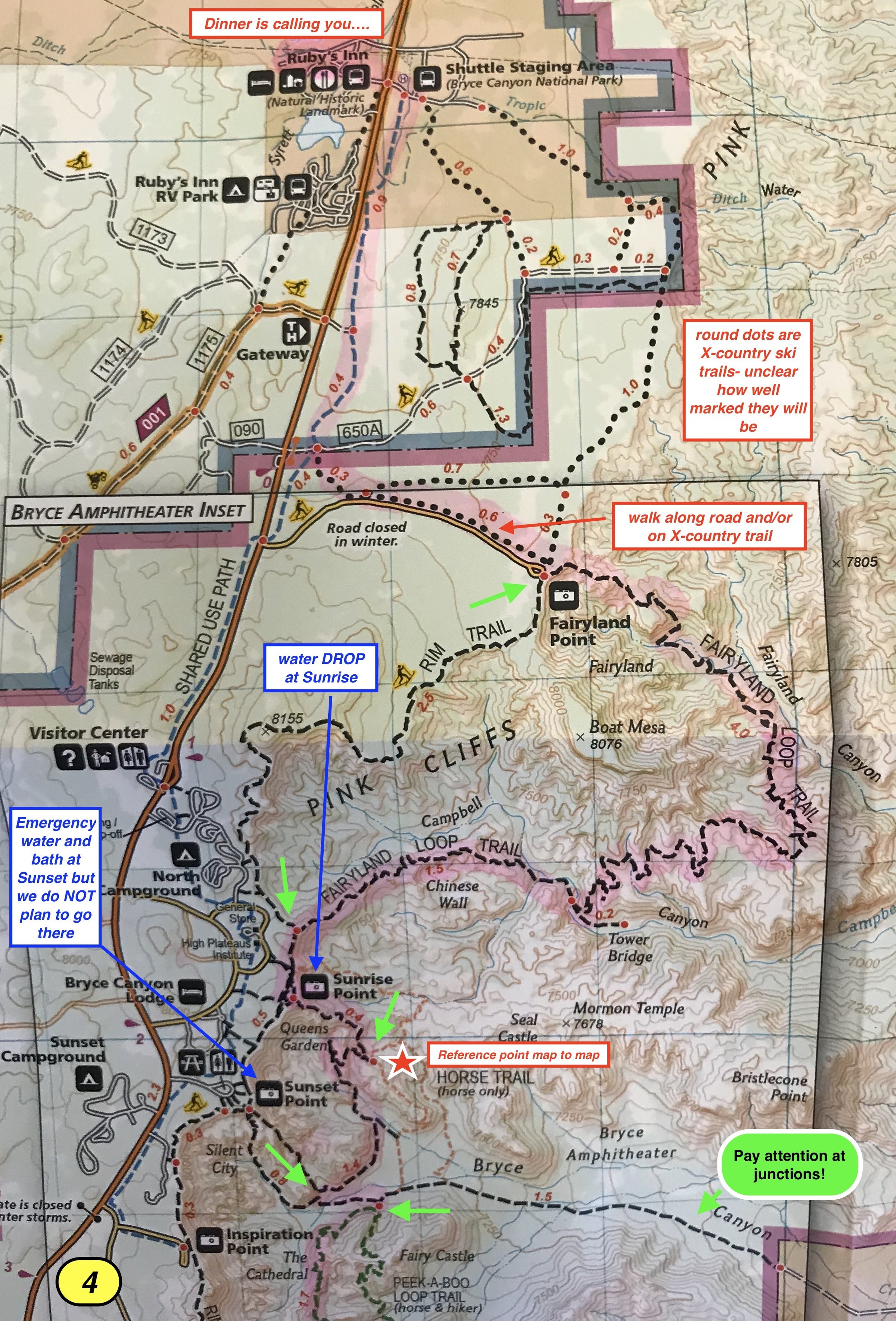
Bryce Canyon Sufferfest Maps - route, natural water location, and planned water drops.